
Now in 3D · Cassopolis
Cassopolis in 3D: A Village Through Time, 1846 to Today
Press one button and the modern village fades away: a white court house on a square of grass and stumps, oxen on State Street, and the windows of the Union Hotel lighting up at dusk. Press it again and you are back in today’s Cassopolis, measured from the air. We rebuilt the county seat of 1846 from the county histories and the old maps, and you can walk the village through time in 3D, from 1846 to 1909 to today.
By Michael Urbanski · Project Scroll · · 22 min read

New finding 1 new finding in this story. See what’s new ›
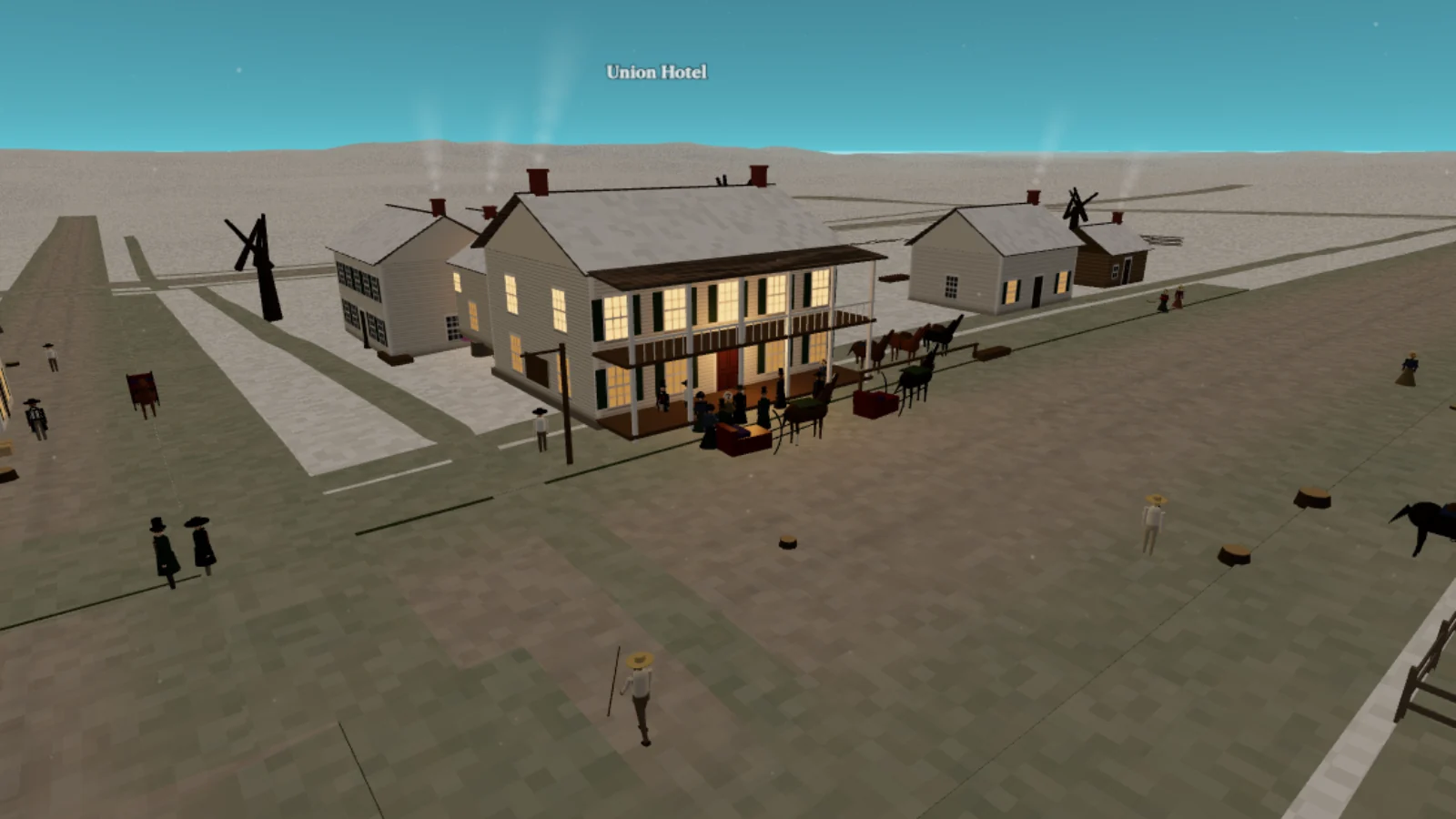
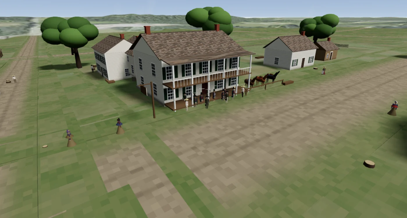
Cassopolis, Mich. Press one button, and the brick shops and the parked cars of today’s Broadway fade away. In their place: a white court house with a cupola, a square of sand, grass and stumps, saddle horses at the hitching rail, oxen hauling lumber down State Street and, as the sun goes down, the windows of the Union Hotel lighting up one by one. This is Cassopolis in 1846, the fifteen-year-old county seat of Cass County, rebuilt in 3D from the county histories, the village plan of 1860 and the fire-insurance maps that caught its last old buildings still standing. You can walk its streets right now. Press the button again and you are back in today’s Cassopolis, measured building by building and tree by tree from the air, on the very same spot.


In the village of 1846
- Switch eras on the spot. The 1846 / Today button swaps the old village and the modern one around you, wherever you stand.
- Seasons and night. In winter the snow falls, the sleighs leave tracks and you can see your breath; slide the sun down and the windows light up.
- Walk or fly. Fly over the square, or walk the board walks at eye level.
- Click any building for what the records say about it, and a small mark tells you how we know: a fire-insurance map, the written record, or a building of the kind.
- The story of the lodge, in nine scenes, and the ball room, with a fiddler, candles and a country dance. Turn the sound on for the reel.
In the village of today
- The real village, measured. Every building at the height the laser survey of 2015 measured, every tree it found, and the country out to Stone Lake and Diamond Lake.
- A guided walk down Broadway, stopping at the stories of the Broadway walk and the shops on the fire map of 1909.
- Slide back to 1909 for a dirt street, buggies at the hitching posts and the painted signs of the shops of that year, or look through an old postcard where its photographer stood.
Welcome to Cassopolis
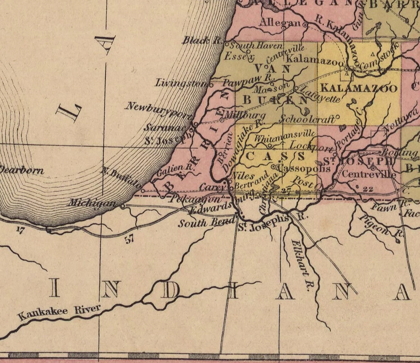
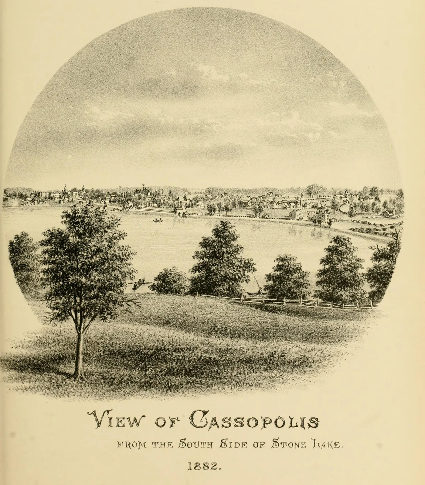
Eight years earlier a state gazetteer summed the place up in one line: Cassopolis was “situated on the north-western border of Stone lake. Here is a court house, jail, 3 stores, a distillery, 2 practicing attorneys, and 2 physicians” (Blois, 18385, p. 261). By 1846 it had grown: more stores, more lawyers, a newspaper, two churches going up, and a frame schoolhouse. But it was still small. When the census-takers counted the village separately for the first time, in 1850, they found 379 people (Mathews, 18822, p. 153). The county around it was filling fast: 5,710 people in 1840, 8,073 at the state census of 1845, and 10,907 by 1850 (Mathews, p. 152).
The heart of the village was the public square, centred on the crossing of Broadway and State Street, twenty-six rods by twenty. For many years it was “an open common” (Mathews, p. 164). A court case of 1880 remembered how it looked: the merchant on its south side kept “lumber, shingles, barrels and boxes” on it, “and with a hitching rack for horses” (Mathews, p. 165). Piecing the village of 1835 together from the memories of its oldest settlers, the history of 1882 pictured “stumps … in all directions” and “little brown paths, worn through the grass into the sandy soil” (Mathews, pp. 156–158). By 1846 the stumps were fewer, but the paths were still sand and grass.
Did you know? Many people supposed that Stone Lake, which has “no visible inlet or outlet,” was a vent of an underground river carrying the water of Lake Superior to the Gulf of Mexico, and that it rose and fell with Superior. Its water is “very fine and very soft”; Diamond Lake’s, half a mile off, is hard (Mathews, p. 11).
New finding Diamond Lake had another name. The state gazetteer of 1838 places a little settlement “on the north side of Deadwood Lake … 2½ miles east of Cassopolis,” and Young’s Prairie, in Penn township, “on the north-east of Deadwood lake” (Blois, 18385, pp. 289 and 383). Both fit Diamond Lake, which lies east of the village toward Penn township, and on whose north shore the county history of 1882 puts that very settlement (Mathews, p. 68). And when the gazetteer lists the county’s lakes it names “Pleasant lake, Stone lake, Deadwood lake,” but no Diamond Lake (Blois, pp. 214–215). So, by our reading, the lake the village knew best was still called Deadwood Lake in the late 1830s.
Around the square
Here is the village as the histories describe it, building by building. Where a history gives a place, we give it; where it does not, we say so. And a few of these buildings were still standing forty years later, when the Sanborn Map Company drew the village for fire insurers, so their size and place can be read off the map. Every one of these buildings stands in the 3D village, and you can click it for its source.
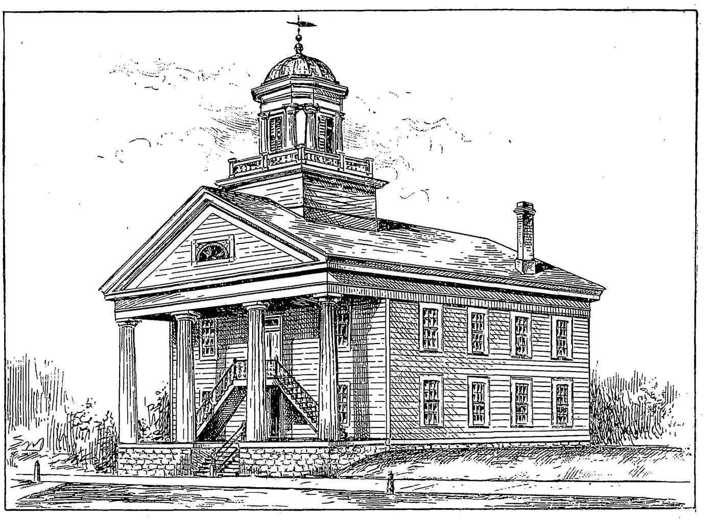
The court house. The pride of the village, finished in 1841. A company of townsmen built it, and the county paid them $6,000, “one-third … in cash and the remainder in village lots” (Mathews, p. 71). Its contract survives: “fifty-four feet in length and forty-six feet in width and twenty-four feet high from sills to the eaves,” of “good pine siding neatly dressed,” “well and neatly painted on the outside white,” with “at least six hundred and twenty-four lights” of glass, a hall twelve feet wide down the middle, offices below, and the court room and two jury rooms upstairs; a brick safe with iron doors kept the county’s records (Mathews, 18822, p. 72). Until the first church was finished it was the village’s meeting hall too. The fire-insurance map of 1884 still draws it, with its porch and steps on the Broadway side: it faced west, toward Broadway (Sanborn map, 18847).
The Union Hotel. Eber Root, licensed to keep a tavern in January 1832, built a frame tavern on the west side of Broadway at the square. In 1835 its outside was “not particularly alluring,” but there was “a crackling wood fire in the bar-room” (Mathews, pp. 157 and 170). It was moved off its lot in 1867 and ended its days as a planing mill that still bore, in faded letters, the words “Union Hotel” (Mathews, p. 170). The fire map of 1884 draws Peck & Lindsey’s planing mill as a frame building, partly two storeys high and partly a storey and a half (Sanborn map, 18847).
The Cassapolis Hotel. Root kept a second house too, on the east side of the square where the Baptist church later stood (Mathews, p. 170; Rogers, 18751, p. 252). It had a ball-room: on 18 February 1847 the Odd Fellows’ lodge “was instituted in the ball-room of the Cassapolis Hotel” (Rogers, p. 254). “The burning of the old Cassapolis House” later moved the village to build in brick (Rogers, p. 246).
The stores. Jacob Silver and Joshua Lofland, partners in the early 1840s, traded part of the time in the old Henderson tavern and in the “Old Red Store,” built in 1832 on the first lot south of the square’s south-west quarter (Mathews, p. 167; Rogers, p. 240; Glover, 19063, p. 149). Asa and Charles Kingsbury kept a general store from about 1836 to 1857, with their lumber and the hitching rack on the square. About 1845 H. C. Lybrook, B. F. Silver and Simeon E. Dow went into partnership, and “in 1846 or the following year” Ezekiel S. and Joel H. Smith opened a store (Mathews, pp. 167–168).
The drug store. “Drugs were kept by all of the merchants,” but nobody made a speciality of them until about 1846, when Redfield & Turner opened a drug store in a brick building, one of the very few in the village; they “also sold fine family groceries and books” (Mathews, pp. 168–169).
Henderson’s double log tavern. The village’s first tavern, of 1831: two log pens under one roof, “on a lot facing east on the south-west corner of the square” (Glover, p. 149). By 1835 a smithy was at one end and a family at the other (Mathews, p. 157).
The jail. Built in 1834 by Eber Root and John Flewelling of “hewn logs one foot square,” fifteen feet by thirty, one storey, with a partition down the middle, two windows and two doors (Mathews, p. 71; Rogers, p. 118). It was floored and lined with plank, and the logs behind were “driven full of nails and bound with strap iron” (Mathews, pp. 71–72). It stood south of State Street, west of the square.
And more. the large frame house Sherman and Redfield built in 1832, the first frame dwelling on the plat, still standing in 1882 as the oldest house in the village (Mathews, p. 156; Glover, p. 149); the Silvers’ distillery “near Stone Lake” (Mathews, p. 169); the Osborns’ harness shop, opened by P. B. Osborn in 1843, where his brother Jordan P. Osborn, a founder of the lodge of 1846, joined him in 1844 and made harness there (Mathews, p. 169); and the burying ground, enlarged after 1840 (Mathews, p. 173).
Making a living
Most of the county farmed, and the village lived off the farms: it sold them goods, ground and distilled their grain, wrote their deeds, tried their quarrels and doctored their fevers. Wheat was the money crop, and it was not worth much. It “regularly sold for fifty cents a bushel for many years” (Glover, p. 201), and seventy-five cents “was considered to be a fair compensation” (Mathews, p. 210). In the winter of 1844 it fetched fifty-two cents at St. Joseph (Mathews, p. 320).
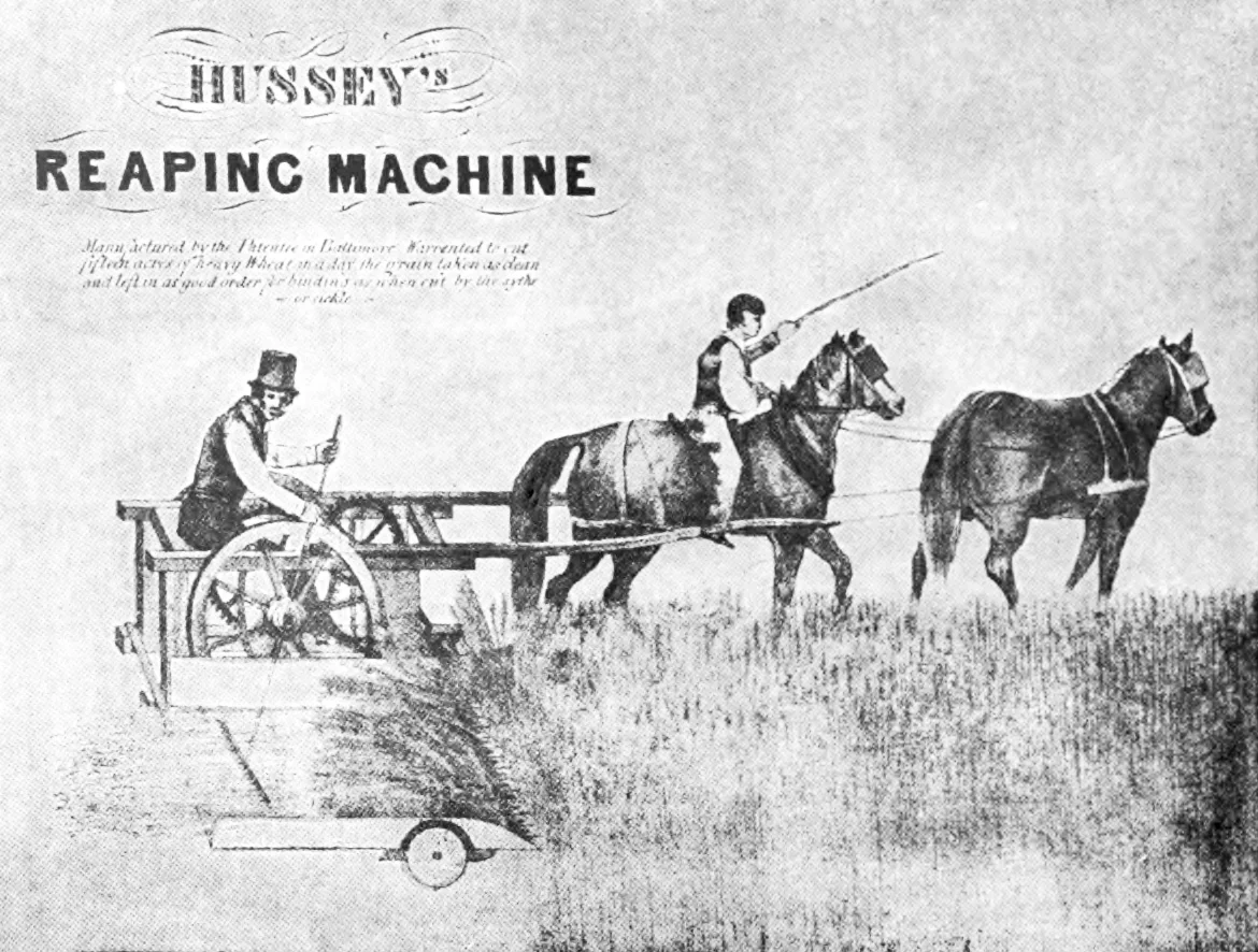
Did you know? The machine age reached Cass County in 1845, when the grain cradle “had a competitor”: a Hussey reaper, brought in by B. Hathaway of Little Prairie Ronde, its horses “driven tandem fashion” (Rogers, p. 108).
In the homes, much was still made by hand. The histories remember linsey and jean cloth, travelling shoemakers who went from house to house, lamps of lard or coon fat, pumpkin rings drying on poles and “pumpkin butter … a staple article the year round,” the Dutch oven and the ash cake, and log-rolling “bees” where the neighbours turned out to help (Rogers, pp. 99–109). These are memories of the pioneer years in general, not of 1846 alone, but in 1846 most of them were still true.
News, mail and the road
The county got its first newspaper on 11 March 1845: the Cass County Advocate, a weekly and Democratic, edited and owned by E. A. Graves, “a small but well-printed sheet” (Mathews, p. 106; Rogers, p. 259). In October 1846 it was sold to Abram Townsend (Rogers, p. 259). The same year brought a rival of sorts, the Literary News of “one O. V. H. McKinney”: “a scurrilous sheet devoted to petty gossip and slanderous personalities,” said Rogers, and it “proved to be short lived” (Rogers, p. 259). What did the early papers print? “Marriages and deaths and births formed the bulk of the local news” (Glover, p. 250).
In 1838 the mail came only once a week. A post route ran from Coldwater to St. Joseph by way of Centreville and Cassopolis, ninety miles, the mail “forwarded and returned once a week,” and another ran from Cassopolis to Elkhart, Indiana, by Edwardsburg and Adamsville (Blois, 1838). From July 1845 a letter cost five cents for under three hundred miles and ten cents for more; the first American postage stamps came in July 1847 (Smithsonian National Postal Museum11). Letters were folded sheets “sealed with wax or a wafer” (Glover, p. 178).
The stages between Kalamazoo and Niles ran daily through the north of the county (Rogers, p. 158). Stages went “perhaps seven or eight miles an hour,” at “five cents a mile” (Glover, p. 169), and passengers arrived, as one history put it, covered with “free soil” (Mathews, pp. 78–79). Change was coming: the Michigan Central Railroad ran its first train into Kalamazoo on 25 January 1846, with regular trips from 2 February (Kalamazoo Public Library9), and reached Niles in 1848 or 1849 (the sources differ), by way of the new town of Dowagiac. It missed Cassopolis, and the village paid for it: “For about twenty years Cassapolis remained almost at a stand still” (Rogers, p. 246).
Doctors, quinine and the shakes
The great illness of the frontier was malaria, the “ague” or “the shakes”; after it came “bronchitis and pneumonia” and “diarrhoea and dysentery induced by their coarse fare,” and “quinine was the sovereign remedy” (Glover, p. 259). Among the village’s doctors in the mid-1840s were Charles L. Clowes, from Virginia, in practice since 1835, whose name was “pronounced Clews”; James Bloodgood, there from 1838 to about 1848; and a young newcomer of 1844, Dr. E. J. Bonine, about twenty-five years old (Mathews, pp. 95–97). Five years later the county’s doctors agreed their fees: fifty cents for “an ordinary visit in the village,” with “Quinine and night visits … extra in all cases” (Mathews, pp. 151–152).
Lawyers and the law
A county seat meant courts, and courts meant lawyers. The most memorable of them may be George B. Turner. He was admitted to the bar on 27 September 1844, and “upon the day he was admitted to the bar” he was himself on trial, for stabbing with a pocket knife “a notorious bully who had made an unprovoked assault upon him.” The jury would “doubtless” have acquitted him altogether, wrote Mathews, had there not been “a couple of Quakers” on it, whose principles “urged them to bestow a slight reprimand”: they found him guilty of simple assault, and he paid the lightest fine the law allowed (Mathews, p. 90). The next year he married Harriet Munroe, and he was soon in the legislature.
The county’s officers elected in 1846 were James L. Glenn and James Shaw, representatives; James N. Chipman, county judge; Barak Mead, sheriff; George Sherwood, county clerk; D. M. Howell, register of deeds; and Joshua C. Lofland, treasurer (Rogers, p. 129). Howell had been unable to walk since the age of two and a half; in March 1846 he married Martha Ann Anderson (Mathews, between pp. 168 and 169).
The biggest case of the decade came in August 1847, when men from Kentucky rode into the Quaker settlements of the county to seize people who had escaped from slavery, and a hearing at Cassopolis set nine of them free. We tell that story, from the papers of 1847, in The Kentucky Raid of 1847.
Church, school and temperance
No church had been built in Cassopolis by 1845; people met in the court house and the schoolhouses. That changed in 1846. The Presbyterians, who had organized in 1842, enclosed their church in 1845, held “a Fourth of July dinner … in the building, for the benefit of the building fund” in 1846, and dedicated it that November (Rogers, p. 251; Mathews, p. 171). It served the congregation until their brick church at State and O’Keefe streets was finished on 10 December 1893 (Glover, p. 353), so the fire map of 1884 still shows it: a frame church of one storey, fifteen feet to the eaves and about thirty-six feet by forty-eight, its door toward Broadway, between State and York streets (Sanborn map, 18847). The same year Jacob Silver, an Episcopalian, and Joshua Lofland, a Methodist, built a church on Rowland Street for the joint use of both, open to all (Rogers, p. 249). It passed to the United Brethren in 1854 and the Methodists in 1855, and was moved away in 1874 (Mathews, p. 170).
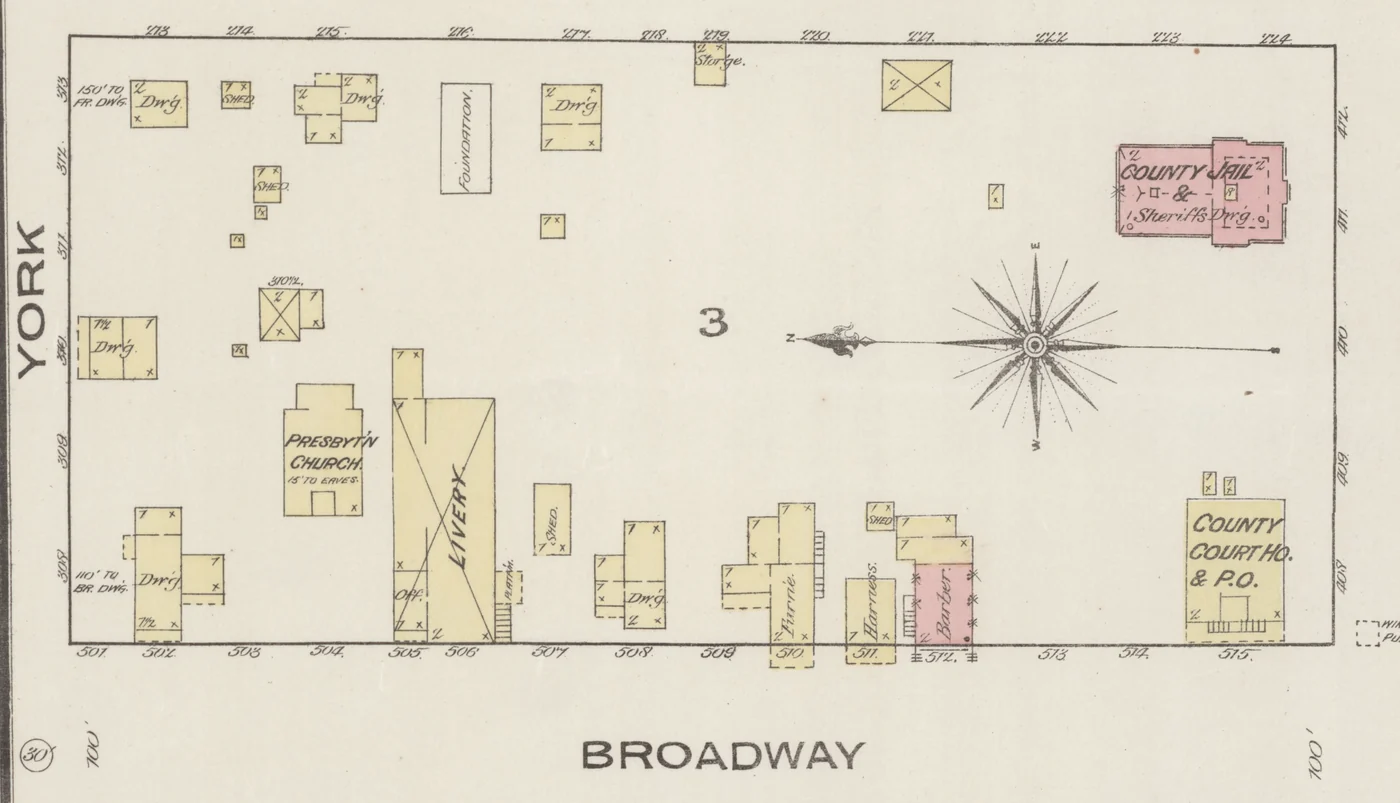
Did you know? The lot for the village’s first frame schoolhouse, built in 1843, was won on a bet: Joseph Harper took it from Jacob Silver over the result of the 1840 election in Pennsylvania (Rogers, p. 245; Mathews, p. 159). The schoolhouse stood on the east side of Rowland Street, and in 1906 it was still there, as John D. Williams’s home (Glover, p. 228). The fire map of 1892 draws a one-storey frame house of about twenty-three feet by thirty on that lot, set back from the street: very likely the old schoolhouse (Sanborn map, 18928).
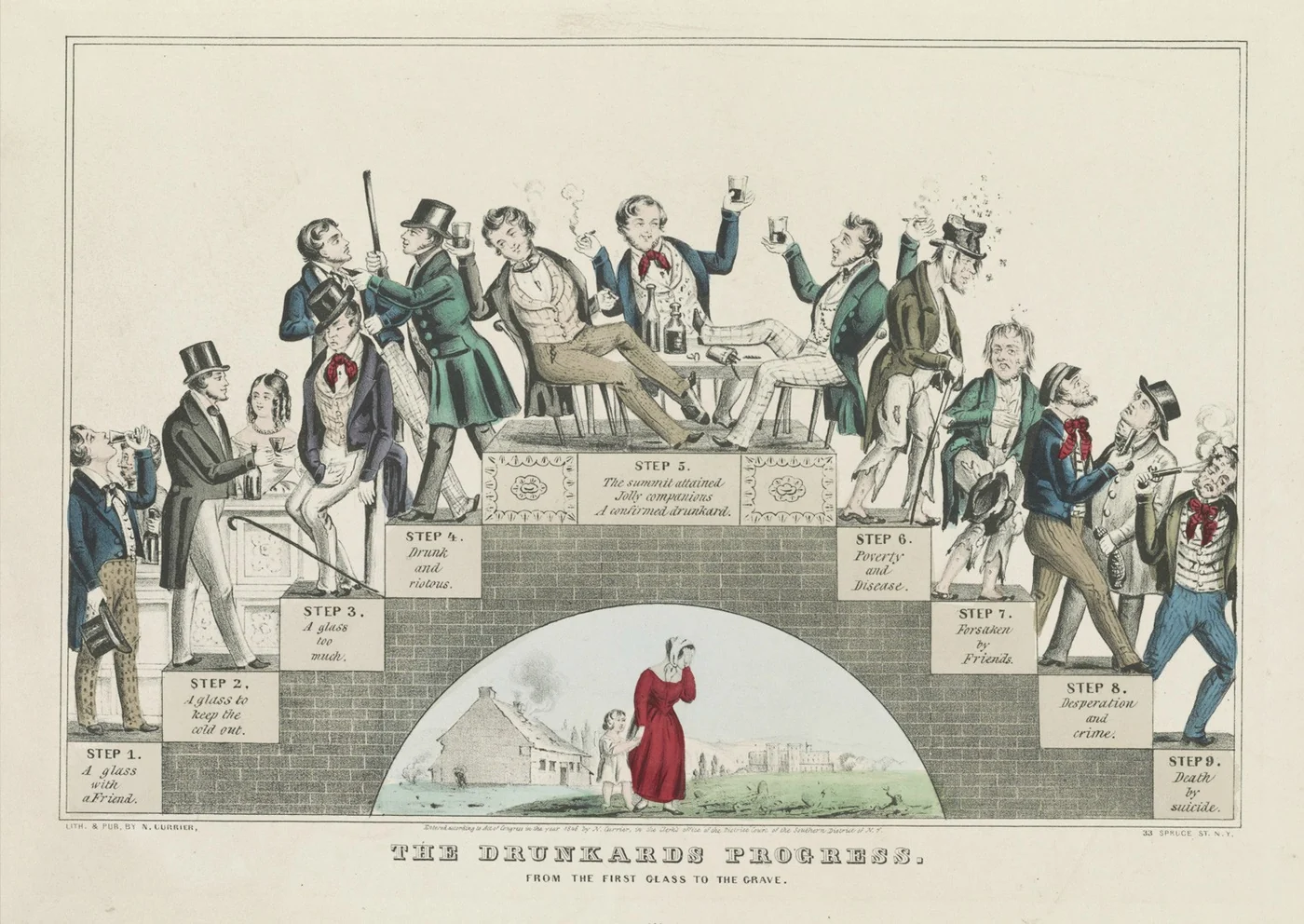
In February 1845 a temperance lecturer, Augustus Littlejohn, came to Cassopolis and spoke in the court house, since “No church had been built in Cassopolis up to that time.” The meetings ran for forty-two nights. “As evening approached, the streets were filled with teams,” and “several hundred people signed the pledge.” His only pay was what he made selling his songbooks (Mathews, pp. 160–161). Thirty years later Rogers could still describe Cassopolis as “a radical temperance town” (p. 261).
Neighbours
The county was a meeting place of many kinds of settlers: newcomers from the eastern states and from Ohio and Indiana, Virginians like Dr. Clowes, and the Quakers of Penn and Calvin townships, who would not help to return those who had escaped from slavery. In 1845 or 1846 a party of free Black farmers came from Logan County, Ohio, and bought small farms in Calvin township, east of the village; land there sold for “from $4 to $5 per acre, with a term of ten years’ credit” (Mathews, p. 386). In 1846, Rogers estimated, there were “one hundred runaway slaves in Cass County, mostly in Penn and Calvin Townships” (Rogers, p. 133).
Fun and frolic
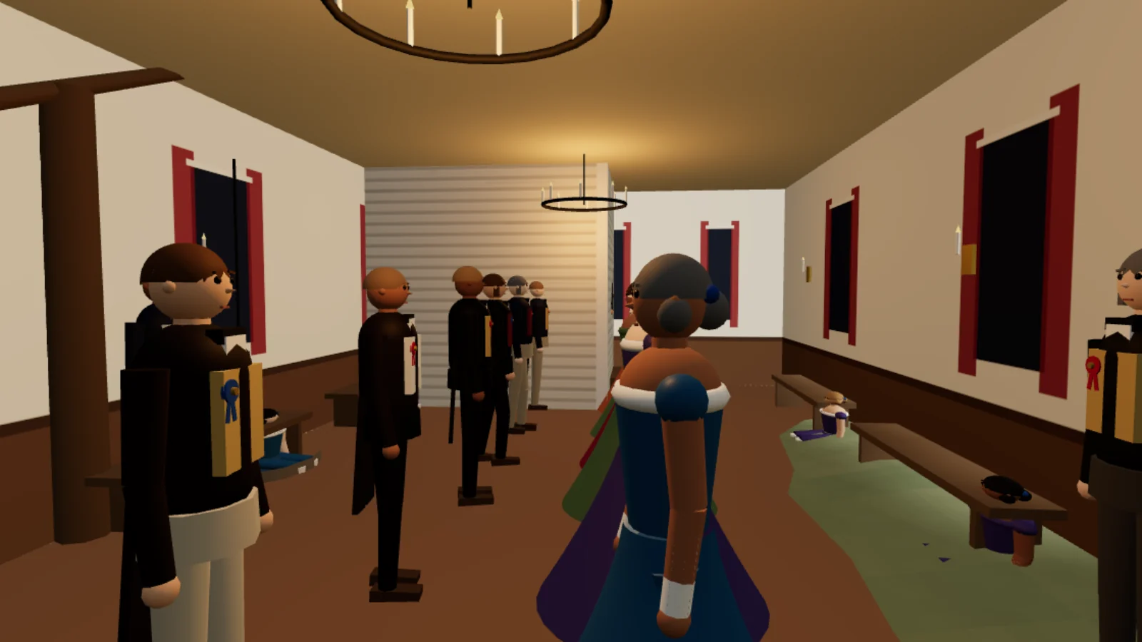
For all the stumps and the ague, the village knew how to enjoy itself. Raisings and log-rollings were social events, the Fourth of July was kept, and the winter, when the roads froze hard and the sleighs came out, was the season for parties. The village had at least one ball-room, at the Cassapolis Hotel. And in the winter of 1846–47 a lighthearted society got up by four young men of the village gave “a grand ball … at the Union Hotel,” at which “over two hundred badges” were worn (Rogers, p. 253): the lodge of 1846 that has made the village a small part of a much bigger story. In the 3D village you can step into the ball room, or play the story of the lodge, from the spring of 1846 to the night of the ball.
1848: bears in the graveyard
The next year brought something nobody expected. In 1848 “black bears were strangely and suddenly numerous,” and “some twenty were killed in the neighborhood of the village, and one was shot within the grave-yard inclosure” (Rogers, p. 246). The same year the county named for Lewis Cass gave him 901 votes for President; four years before, it had preferred Henry Clay to James K. Polk (Mathews, p. 153). Within a year or two the trains were running into Niles, and the busy years of the little county seat were, for a while, over.
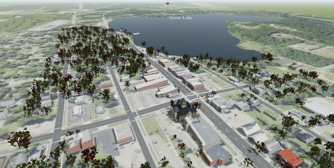
Cassopolis today, in 3D
The village of 1846 is one half of the model. The other half is the village as it stands now, and it is built from measurements anyone can check. In 2015 an aircraft swept Cass County with a laser; every echo off a roof, a tree or the bare ground was recorded. From those echoes every building in Cassopolis is raised to the height the laser measured and every tree drawn where it stands, on the shape of the land itself, with the aerial photograph laid on it. The court house of 1899 and the library are built by hand from the old postcards. The result is the whole county seat, from the square to Stone Lake and out to Diamond Lake, which you can walk at eye level or fly over (Broadway in 3D; how it was made, step by step, is on the same page).
- The guided walk. Down Broadway at walking pace, stopping at each story of the Broadway walk and at the places the fire map of 1909 names, with a quick question at each story for a stamp.
- Back to 1909. Slide the time to 1909 and the cars and street lamps of today give way to a dirt street, buggies at the hitching posts and an arc lamp over the crossing, with each shop of that year hung with a painted sign where it stood.
- Look through the postcard. At the stops with an old postcard, the view moves to where the photographer stood, and a slider fades between the card and the street today.
- The laser points themselves, the survey’s echoes off the rooftops and trees around the court house, exactly where they fell. Our story Fly over Cassopolis, laser point by laser point tells how they were gathered.
- Diamond Lake. Its depth lines on the water, and a steamer ride past the sites of the old resorts.
- Measure, in VR, in Spanish. Click two points for the distance between them, or a building for its height; open the page in a Meta Quest or Apple Vision Pro to stand in the street at full size; or press Español for the controls and the narration in Spanish.
And then, wherever you stand, press 1846, and today’s Cassopolis gives way to the village this story is about.
What is from the record, and what is not: the court house is drawn from its contract and its old pictures, the engraving of 1899 and the photograph in the county history of 1906; the church and the schoolhouse take their size and place from the fire-insurance maps of 1884 and 1892; the other buildings are placed where the histories put them, as nearly as they allow, and drawn in the manner of the time, since no pictures of them survive. The people, the animals, the inside of the ball room and the dance are imagined. Project Scroll is independent research, not affiliated with E Clampus Vitus or any other organization named here.
Questions people ask
How big was Cassopolis in 1846?
Small: 379 people lived in the village when it was first counted separately, in 1850. The whole of Cass County had 8,073 people at the state census of 1845.
What was there?
The court house of 1841 on the public square, two hotels, Henderson’s old double log tavern, several stores and a drug store, a log jail, a distillery, a harness shop, a frame schoolhouse, two churches being built in 1846, and the offices of the county’s lawyers, doctors and newspaper.
Did Cassopolis have a newspaper in 1846?
Yes. The Cass County Advocate, the county’s first newspaper, began on 11 March 1845. A short-lived gossip sheet, the Literary News, appeared in 1846.
When did the railroad come?
The Michigan Central reached Kalamazoo in 1846 and Niles in 1848 or 1849, by way of Dowagiac. It passed Cassopolis by.
Can I walk around the village?
Yes. Open Broadway in 3D and choose 1846 to walk the village as the county histories describe it, by day or by night, in any season.
Is there a 3D model of Cassopolis today, too?
Yes. The same page holds the village as it stands now, built from the laser survey of 2015: every building at its measured height, a guided walk down Broadway, the shops of 1909 and the old postcards. The 1846 / Today button switches between the two on the spot.
A timeline
- 1831 The village is platted; Henderson’s double log tavern goes up.
- 1832 Eber Root’s tavern, the Old Red Store and Sherman and Redfield’s frame house are built.
- 1834 The log jail is ready.
- 1841 The new court house is in use on the public square.
- 1843 The first frame schoolhouse, on a lot won on a bet.
- Feb 1845 Forty-two nights of temperance meetings in the court house.
- 11 Mar 1845 The Cass County Advocate, the county’s first newspaper.
- 1845 A Hussey reaper reaches the county; the state census counts 8,073 people in Cass County.
- 25 Jan 1846 The first train reaches Kalamazoo.
- 1846 The Literary News; Redfield & Turner’s drug store; the union church on Rowland Street.
- 4 Jul 1846 A Fourth of July dinner in the unfinished Presbyterian church.
- Nov 1846 The Presbyterian church is dedicated.
- Winter 1846–47 A grand ball at the Union Hotel.
- 18 Feb 1847 The Odd Fellows’ lodge, in the ball-room of the Cassapolis Hotel.
- Aug 1847 The Kentucky raid, and the hearing at Cassopolis.
- 1848 Bears in the graveyard.
- 1848–49 The Michigan Central reaches Niles.
- 1850 379 people in the village.
Sources
- Howard S. Rogers, History of Cass County, from 1825 to 1875 (Cassopolis, 1875), pp. 99–109, 118, 129, 133, 158, 240, 245–246, 249, 251–254, 259, 261. Internet Archive.
- History of Cass County, Michigan (Chicago: Waterman, Watkins & Co., 1882; edited by Alfred Mathews), pp. 11, 68, 71–72, 78–79, 90, 95–97, 106, 151–153, 156–174, 210, 320, 386. Internet Archive; pp. 152 and 166–167 read in the University of Michigan copy.
- L. H. Glover, A Twentieth Century History of Cass County, Michigan (Chicago, 1906), pp. 145–150, 169, 178, 201, 228, 249–250, 259, 353. Internet Archive.
- L. H. Glover, “Historical Sketch of Cassopolis,” in Norton’s Directory (1899), pp. 232–238, with the engraving “Old Court House, Cass County,” p. 234. University of Michigan, Internet Archive.
- John T. Blois, Gazetteer of the State of Michigan (Detroit, 1838): Cassopolis, p. 261; the Cass County lakes, pp. 214–215; “Deadwood Lake,” pp. 289 and 383; post routes, pp. 98–99. Internet Archive.
- S. Augustus Mitchell, A New Map of Michigan with its Canals, Roads & Distances (Philadelphia, 1846). University of Michigan Library, Clark Library.
- Sanborn Map Company, Sanborn Fire Insurance Map from Cassopolis, Cass County, Michigan, November 1884, sheets 1–2. Library of Congress, Geography and Map Division.
- Sanborn Map Company, Sanborn Fire Insurance Map from Cassopolis, Cass County, Michigan, August 1892. Library of Congress, Geography and Map Division.
- Kalamazoo Public Library, “Kalamazoo’s Railroads.”
- Michigan railroad timeline, 1848.
- Smithsonian National Postal Museum, “Postmasters’ Provisionals, 1845–1847.”
- Project Scroll, “The Kentucky Raid of 1847.”
- Project Scroll, “A lodge of E Clampus Vitus, in Cassopolis, in 1846.”
- Nathaniel Currier, The Drunkard’s Progress, from the First Glass to the Grave (New York, 1846). Library of Congress, Prints and Photographs Division; Wikimedia Commons.
- “Hussey’s Reaping Machine,” advertising print, reproduced in Follett L. Greeno, ed., Obed Hussey, Who, of All Inventors, Made Bread Cheap (Rochester, 1912). Wikimedia Commons.
- Project Scroll, “Broadway in 3D” (the 3D model of Cassopolis, 1846 and today, with how it was made).
- Project Scroll, “Fly over Cassopolis, laser point by laser point.”
Numbers in the text point to this list; entries without a number are further sources we consulted. How we research › · The libraries behind all our stories ›
Cassopolis in 3D: step into 1846 Walk Cassopolis today, in 3D E Clampus Vitus in Cassopolis, 1846
Corrections: none
First published 2 November 2026. Like all our pages, it is expanded from time to time with new records, pictures and features. No factual corrections have been needed so far.
About this research
Research and reporting Michael Urbanski Project Scroll
- Sources
- Every fact on this page is drawn from the sources listed above, and each can be checked where it is held.
- Corrections
- Errors are corrected on the page, and each correction is noted there.
- Contact
- To report an error or share a record that adds to the story, write to research@projectscroll.com.
- Method
- How we research ›
© 2026 Michael Urbanski and Project Scroll. All rights reserved. The text, original maps, charts and illustrations may not be reproduced without permission; brief quotations with credit and a link back are welcome. Material from other sources belongs to its holders and is credited where it appears; public-domain material is marked as such.


